Dec 08, 2005 - Sale 2060

Sale 2060 - Lot 82

Price Realized: $ 10,925
?Final Price Realized includes Buyer’s Premium added to Hammer Price
Estimate: $ 10,000 - $ 15,000
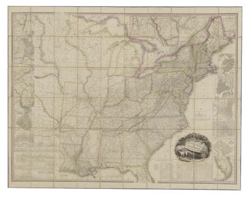
TANNER, HENRY SCHENCK. United States of America. Large engraved case map in 60 sections. 1165x1545 mm overall; hand-colored in outline; linen-backed, with publisher's 1/2 roan case, neatly rebacked and retipped, with most of the original back retained, covers rubbed; housed in a modern cloth folding box with the First and Second editions of Tanner's "Memoir on the Recent Surveys, Observations and Internal Improvements in the United States" (1829 and 1830). Philadelphia, 1829

Additional Details


Map shows the United States from the Atlantic ocean to what today is western Kansas (noted as "Kanzas" on map). To the west of Michigan Territory and Missouri large swaths of land contain numerous Indian tribe names and are designated as "Districts" rather than Territories - District of Huron, Sioux District, Mandan District, Osage District and Ozark District. Texas is not shown, being still a part of Mexico, and its area is used for the profiles of canals and railroads. "This is one of the best early large maps of the United States and the premier map for its period, without equal until Mitchell produced the first edition of his Reference and Distance Map of the United States in 1834"--Rumsey 975. The map is accompanied by the First and Second Editions of Tanner's "Memoir" which complimented the map.Both in 12mo format and both in the publisher's 1/2 calf. Philadelphia, 1829; 1830. Rumsey 2233, Rumsey 4625. Ristow, page 198.