Jun 14, 2007 - Sale 2118

Sale 2118 - Lot 15

Price Realized: $ 7,800
?Final Price Realized includes Buyer’s Premium added to Hammer Price
Estimate: $ 8,000 - $ 12,000
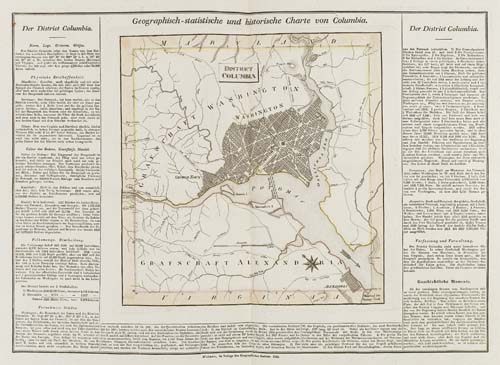
WEILAND, C. F. Geografisch Statistischen Atlas einigen Amerikanischen Staaten [from paper label on front cover]. Composite atlas consisting of 13 double-page engraved maps of American subjects; each hand-colored in outline. Folio, 535x340 mm, contemporary 1/2 cloth over marbled boards, slight wear at extremities; maps in lovely condition; modern cloth folding case. Weimar, 1820s

Additional Details

In the syle of the atlases of Buchon and Carey & Lea, with a map surrounded by text. These maps were made for the Geographical Institute of Weimar and were issued separately. This composite atlas was put together very close to the publication of the maps, and the maps are amongst the last done by Weiland in his series of American subjects. Though they bear resemblances to Buchon and Carey, they are their own productions, covering more restricted areas and with greater local detail. Maps of U. S. interest include: Arkansas Territory, Michigan and Northwest Territory, Florida, District of Columbia, British North America, Virginia, and Missouri and Oregon Territory. There is also a map of the Polar region which has no equivalent in either Buchon or Carey.