?Final Price Realized includes Buyer’s Premium added to Hammer Price
Estimate: $ 8,000 - $ 12,000
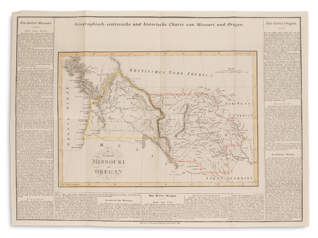
WEILAND, CARL FERDINAND. Atlas von Amerika. 38 engraved folding maps with original outline hand-coloring; approximately 22x26 1/2 inches each sheet size, extra wide margins; housed in 9 contemporary marbled paper slipcase boxes with gilt stamped paper title labels (one box slightly larger than the group.) The entire package in remarkable preservation; map of Colombia with neat manuscript marginalia. Weimar, 1823-28
A beautiful and unusually sophisticated format of this rare German variation of Carey & Lea's American Atlas (Philadelphia, 1822.) A French edition was also published by Buchon in Paris in 1825. The German edition is the rarest, and even more notably so in such a unique and appealing presentation as offered here. Weiland's maps are an improvement upon the original American geography but follow in the style of incorporating descriptive text panels around the map. As the maps were published separately, collections and completeness appear to vary. The example at the Library of Congress contains 30 maps. Maps per individual folder: Maine, New Hampshire, Massachusetts, Rhode Island; Connecticut, Vermont, New York, New Jersey; Pennsylvania, Delaware, Maryland, North Carolina, South Carolina; Georgia, Ohio, Kentucky, Tennessee; Mississippi, Louisiana, Alabama, Indiana; Illinois, Missouri, Mexico, Guatemala; Arkansas, Florida, Michigan, Missouri/Oregon Territory, Central America; Cuba/Bahamas, Jamaica, Haiti, Colombia; Brazil, Peru, Chile, Plata River. Phillips 1225.