Dec 08, 2005 - Sale 2060

Sale 2060 - Lot 116

Price Realized: $ 3,680
?Final Price Realized includes Buyer’s Premium added to Hammer Price
Estimate: $ 1,000 - $ 1,500
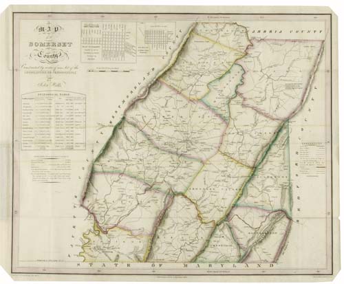
WELLS, JOHN; MELISH, JOHN; and TANNER, H.S. Map of Somerset County. Constructed by virtue of an Act of the Legislature of Pennsylvania by John Wells. Engraved folding pocket map, 450x560 mm overall; hand-colored in outline; folds into the original gilt-lettered 12mo format roan case. With a binder containing photocopies of Wells' contract for the production of this map, as well as other contemporary documents relating to the map, including a letter from Wells to Melish stating that he was having difficulty obtaining subscriptions for the map. Philadelphia, 1830

Additional Details


A great rarity, with attribution to 3 great names of American cartography - John Melish, Benjamin Tanner and Henry Schenck Tanner. Wells signed a contract with the state on 12 August 1816 agreeing to prepare the map of Somerset County for $600. He completed the map on 09 October 1818. Probable Second Edition. Wells is known to have delivered the original manuscript map to Melish in the second half of 1818, giving Melish plenty of time to publish the map prior to his death in 1822. No known copy of the map without the Tanner imprint is known however.