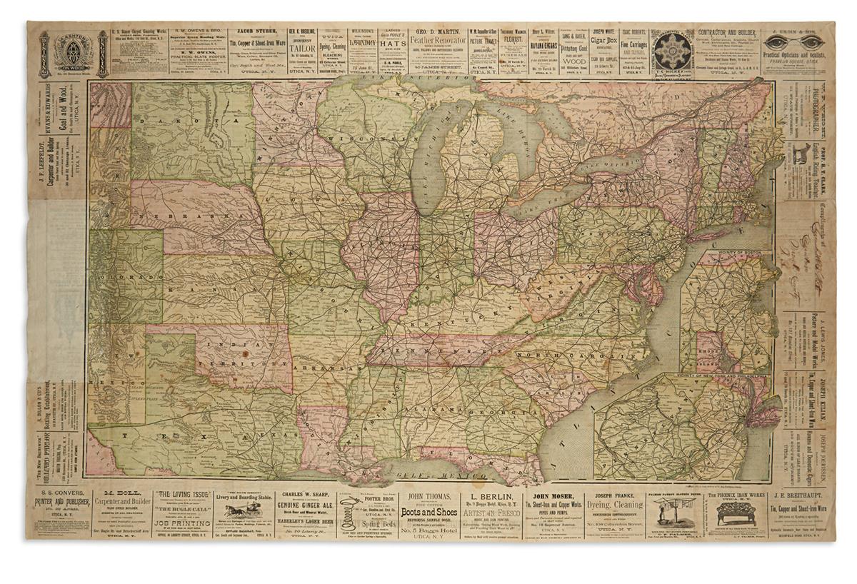
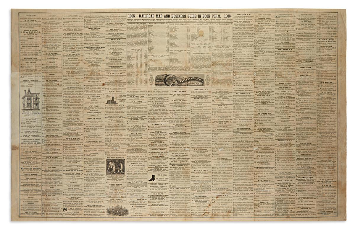
(RAILROADS and ADVERTISEMENTS.) Railroad Map and Business Guide in Book Form 1885-1886. Large color-printed lithographed folding railroad map of the United States. 26x40 3/4 inches sheet size; originally folding, now flat, few minor repairs at fold intersections, slight discoloration where removed from covers, contemporary presentation inscription in ink. New York: Hannifan & Co., 1886
Large railroad map of the United States west to Colorado with insets of New York City and Boston vicinities by Rand, McNally & Co. Hundreds of diverse business advertisements appear on the verso and borders the map. OCLC locates one copy.