?Final Price Realized includes Buyer’s Premium added to Hammer Price
Estimate: $ 1,500 - $ 2,000
(CASE MAPS.) Group of 14 seventeenth-through-nineteenth-century engraved or lithographed case maps of various locations. Individual photographs on request. Vp, vd
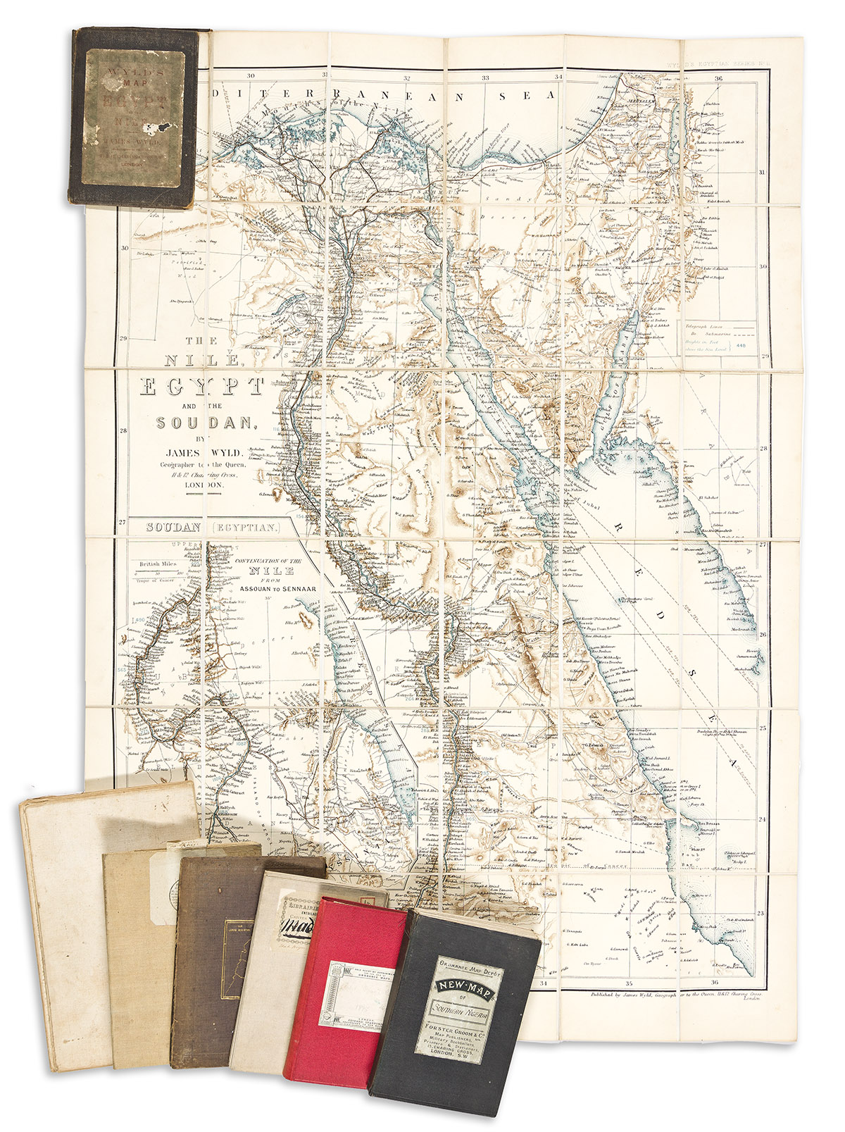
- James Wyld. The Nile, Egypt and the Soudan. 39x27 3/4 inches overall, segmented, mounted on original linen backing and folding into publisher's 8vo format cloth case; minor wear. London, circa 1880.
- Edward Stanford. The Central & Eastern Provinces of Southern Nigeria. 33 3/4x58 inches overall, segmented, mounted on original linen backing and folding into publisher's 8vo format cloth case; minor wear. London, 1910.
- British Intelligence Division, War Office/Edward Stanford. Map of the Gold Coast Colony and Neighbouring Territories. 26x40 1/2 inches overall, segmented, mounted on original linen backing and folding into publisher's 8vo format cloth case; minor wear. London, 1895.
- Service Geographique de l'Armee. Carte de Madagascar. 37x24 inches overall, segmented and mounted on original linen backing; minor wear. Paris, 1894.
- Robert Mimpriss. Mimpriss's Initiatory Chart to Our Lord's Life & Ministry. 31x26 inches overall, segmented, mounted on original linen backing and folding into publisher's 8vo format cloth case (front cover detached); minor toning. London, circa1830s.
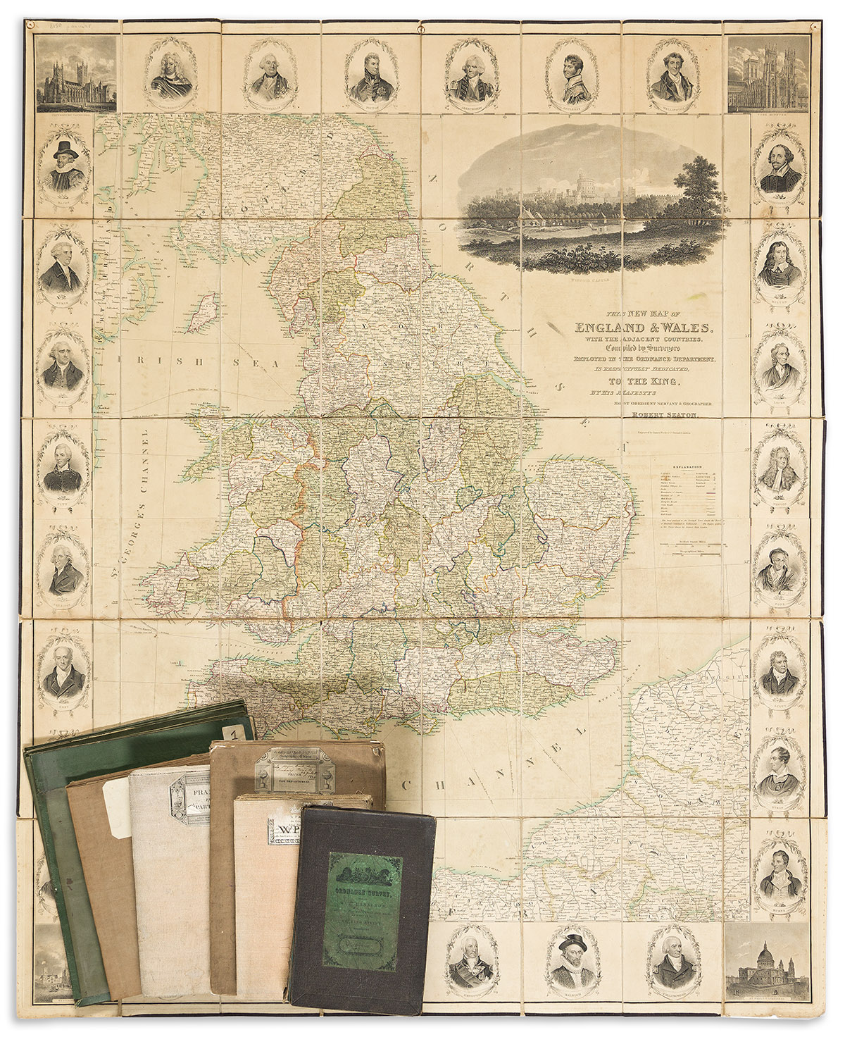
- Robert Seaton. This New Map of England & Wales, with the Adjacent Countries... 47x38 1/2 inches overall, segmented, mounted on original linen backing with green selvage and folding into patterned moire paper self-wrappers; moderate wear and age toning. London, circa 1830.
- Ordnance Map Office. City of Edinburgh. 50 1/4x38 1/2 inches overall, segmented, mounted on original linen backing and folding into publisher's 8vo format cloth covers with printed paper label; minor signs of age. London, 1854.
- C.F. Delamarche. Theatre de la Guerre ou Carte des Frontieres de la Republique Francaise et de l'Empire d'Allemagne. 28 1/2x40 inches overall, segmented and mounted on original linen backing; minor wear. Paris, 1793.
- Dr. R. Jannasch. Spezialkarte von Santa Catharina Rio Grande do Sul und Uruguay. 41 1/4x40 1/2 inches overall, segmented and mounted on original linen backing; moderate wear. Berlin, 1907.
- Alexandre Berthier/P.F. Tardieu. Carte de l'Empire Francois. 27x42 inches overall, segmented and mounted on original linen backing; moderate wear. Paris, 1807.
- Adrien-Hubert Brue/Andriveau-Goujon. Carte Physique, Administrative et Routiere de la France. 45 1/2x62 3/4 inches overall, segmented and mounted on original linen backing; moderate wear. Paris, 1836.
- Adrien-Hubert Brue. Carte Physique, Administrative et Routiere de la France. 44 1/2x61 3/4 inches overall, segmented and mounted on original linen backing; staining, worm track. Paris, 1818.
- Heinrich Berghaus. Post-Charte vom Preussischen Staate, in XXV Blattern. 36x49 inches overall, segmented, mounted on original linen backing; heavy offsetting. Berlin, 1825.
- Overzichtskaart van Java en Madoera. 4 sections, 24x21 inches each, segmented and mounted on original linen backing; various stains and damages. [The Hague?, circa 1900].