Dec 10 at 12:00 PM - Sale 2689 -

Sale 2689 - Lot 88

Estimate: $ 1,000 - $ 1,500
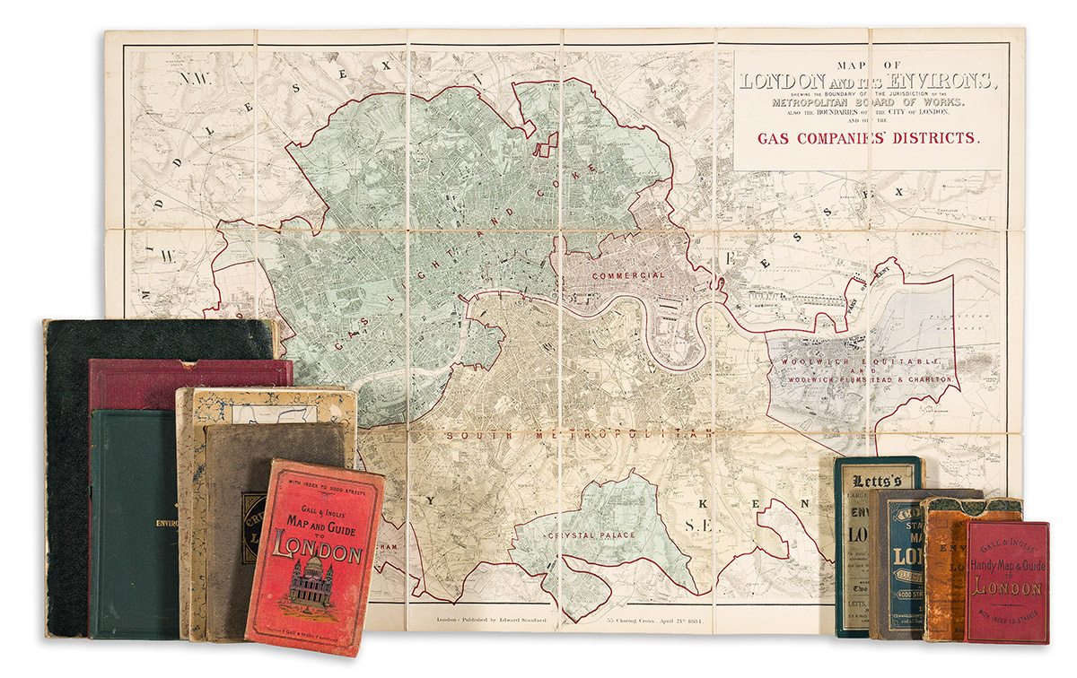
(LONDON.) Group of 12 nineteenth-and-early-twentieth-century case maps. Individual photographs on request. London, vd

Additional Details

Gall & Inglis. Handy Map and Guide to London. Chromolithograph; 20x29½ inches overall, mounted on original linen backing and folding into publisher's 12mo format red cloth case with 24-page index; booklet separated, otherwise minor signs of age. London, circa 1890.

G.F. Cruchley. Cruchley's Improved Environs of London. Hand-colored engraving; 23¾x23¾ inches overall, segmented, mounted on original linen backing and folding into marbled paper self-wrappers and original card slipcase with printed paper label; moderate signs of age. London, 1826.

Letts, Son & Co. Letts's Large Print Map of the Environs of London. Chromolithograph; 28x33 inches overall, mounted on original linen backing and folding into publisher's tall 8vo format cloth case with printed paper label; minor signs of age. London, circa 1885.

Edward Stanford. Collins' Standard Map of London. Hand-colored lithograph; 31x35 inches overall, segmented, mounted on original linen backing and folding into publisher's 8vo format cloth case with printed paper label; minor signs of age. London, circa 1880.

Gall & Inglis. Gall & Inglis' Large Scale "Five Inch" Map of London. Double-sided lithograph, primary side color-printed; 29½x40½ inches overall and folding into publisher's 8vo format red cloth covers with an index of streets; minor wear, booklet separated. London, circa 1900.

G.F. Cruchley. Cruchley's New Plan of London. Hand-colored lithograph; 35¾x45½ inches overall, segmented, mounted on original linen backing and folding into publisher's 8vo format cloth case; minor wear. London, circa 1860s.

Edward Stanford. Map of London and Its Environs, Shewing the Boundary of the Jurisdiction of the Metropolitan Board of Works. Also the Boundaries of the City of London, and of the Gas Companie's' Districts. Hand-colored lithograph with overprint in red; 26¾x40½ inches overall, segmented and mounted on original linen backing and folding into marbled paper self-wrappers; small separations at fold lines. London, 1884.

London County Council. Map Showing Elementary and Secondary Schools in the County of London. Chromolithograph; 39¼x41¼ inches overall, segmented, mounted on original linen backing and folding into marbled paper self-wrappers; minor wear. London, 1907.

Edward Stanford. West Lambeth. [Map of schools]. Color-printed lithograph; 43x50¾ inches overall, segmented, mounted on original linen backing and folding into marbled paper self-wrappers; minor wear. London, circa 1900.

G.W. Bacon & Co. Bacon's Library Map of the Environs of London. Color-printed lithograph; 39x58½ inches overall, segmented, mounted on original linen backing and folding into publisher's gilt-blocked cloth slipcase; minor wear. London, circa 1900.

G.W. Bacon & Co. Bacon's Map of Central & West London. Color-printed; 2 sections, 48x33½ inches each, segmented, mounted on original linen backing and folding into publisher's 4to format gilt-blocked red cloth slipcase; minor wear. London, circa 1900.

Geographia, Ltd. [Oversize map of London based on the Ordnance Survey]. Lithograph overprinted in red and blue; 56½x72 inches overall, segmented, mounted on original linen backing and folding into cloth self-wrappers; minor wear. London, circa 1900.