Jun 23, 2022 - Sale 2610

Sale 2610 - Lot 106

Price Realized: $ 3,000
?Final Price Realized includes Buyer’s Premium added to Hammer Price
Estimate: $ 2,500 - $ 3,500
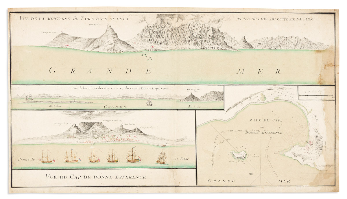
(MANUSCRIPT MAP -- CAPE TOWN.) Vue de Cap de Bonne Esperence. Pen and ink and watercolor wash on laid paper. 12 3/4x22 3/4 inches sheet size, ample margins; stain at right edge, backed with thin tissue stabilizing small tears. [Np, circa 1730s]

Additional Details

Finely drawn arrangement of a harbor plan and three coastal views of the Cape of Good Hope, South Africa.

The plan demonstrates vessel routes in from the north and south, as well as soundings along the coast and around Robben Island. The elevations provide different vantages of the coastal topography witnessed from the sea - in addition to a tiny Cape Town, there are several notable labeled landmarks: Table Mountain, Lion's Head, Lion's Rump (Signal Hill), Robben Island, and Dutch East India Company fortifications and garrisons (Pentagone, i.e., Castle of Good Hope; Batterie - Chavonnes Battery). Large merchant ships are seen anchored in the harbor, most bearing the Dutch flag and others a British Red Ensign.