?Final Price Realized includes Buyer’s Premium added to Hammer Price
Estimate: $ 5,000 - $ 7,500
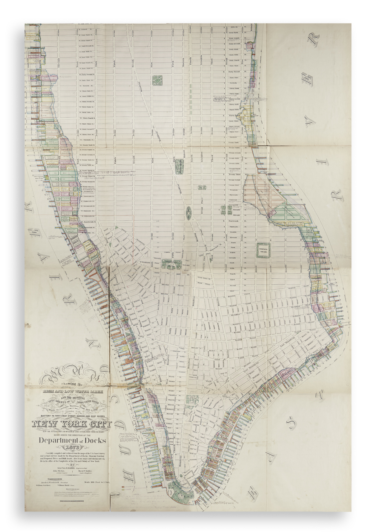
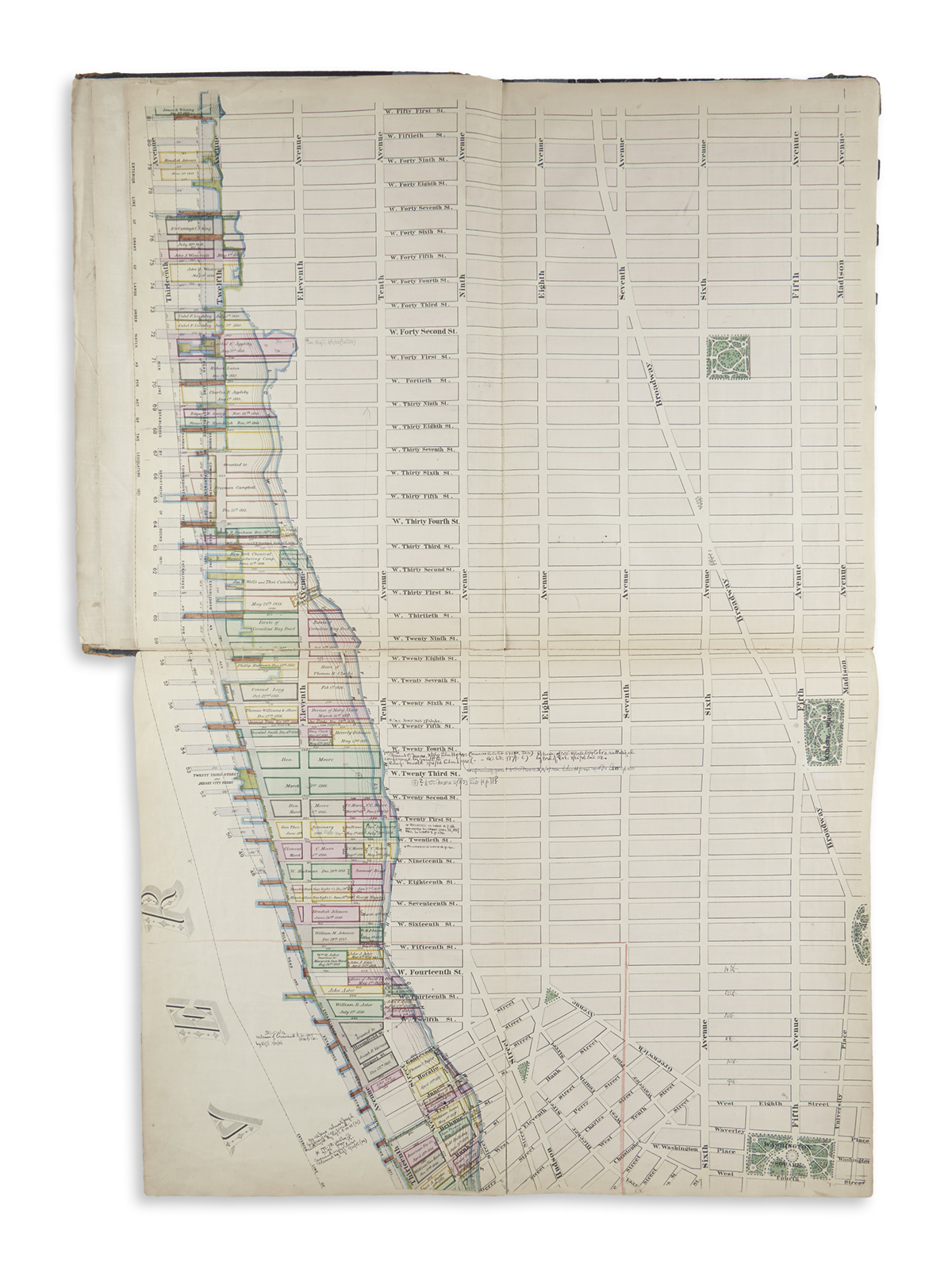
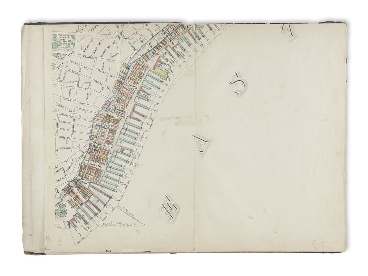
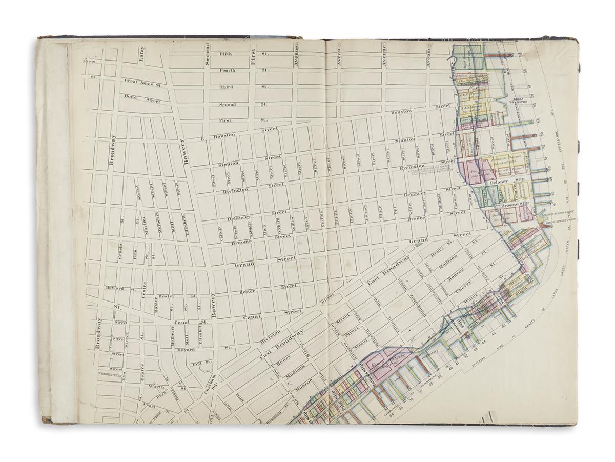
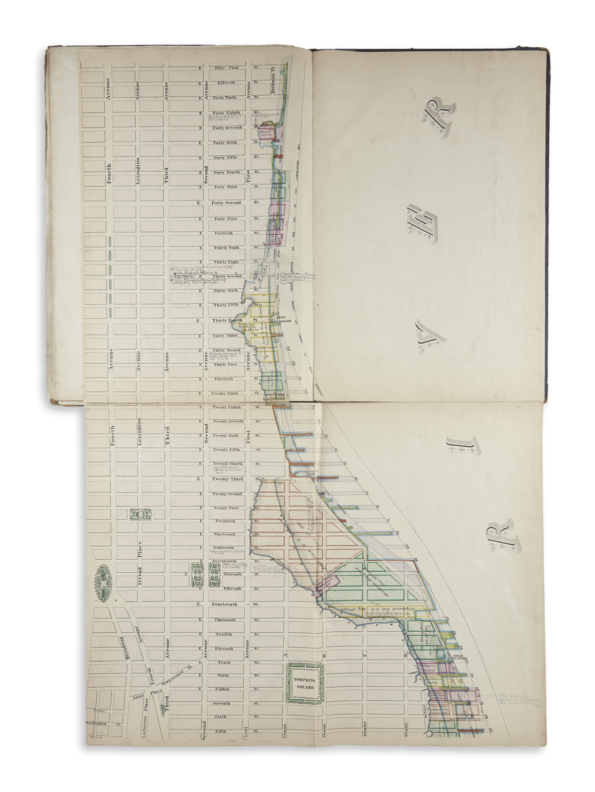
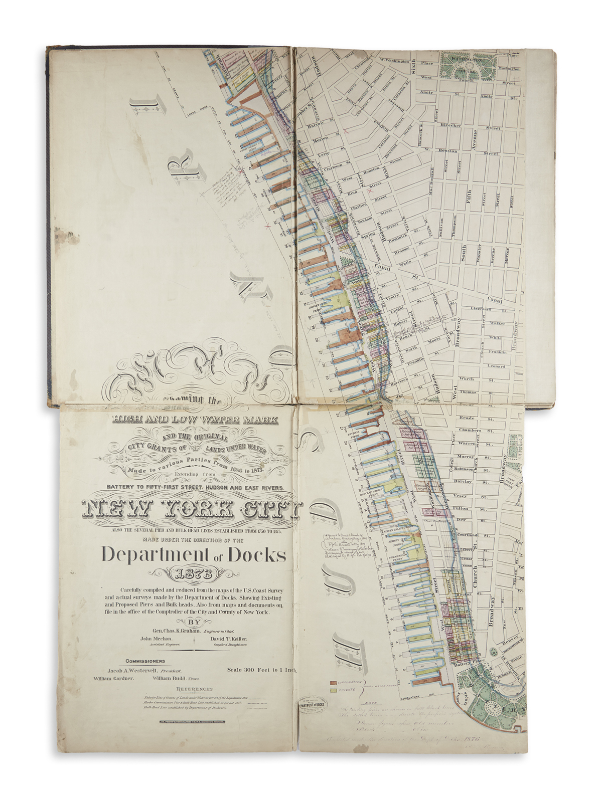
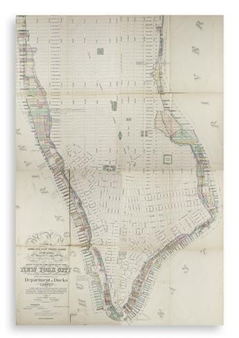
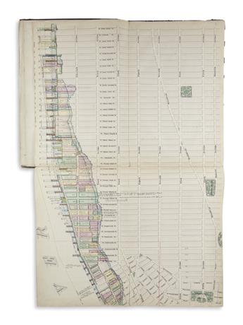
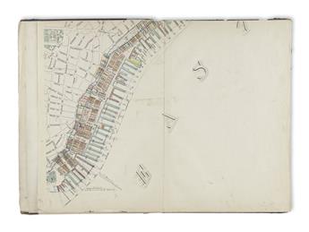
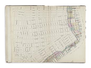
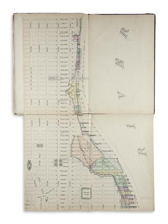
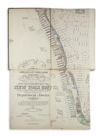
(NEW YORK CITY.) Department of Docks; Graham, Charles Kinnaird. Map Showing the High and Low Water Mark and the Original City Grantsof Lands Under Water Made to Various Parties from 1686 to 1873. Extending from Battery to Fifty-First Street, Hudson and East Rivers, New York City. Hand-colored lithographed map on 16 folio sheets, backed on linen and folding into period boards with gilt blocked morocco cover label; boards worn and spine repaired with silver tape. Each sheet size approximately 20 3/4x13 1/2 inches; assembled would measure approximately 83x54 inches; scattered light staining, linen separated with some soft creasing and wear along several folds, manuscript annotations in pencil and ink. New York, 1873
An incredible plan of Manhattan which would stand an imposing 7 feet tall when assembled. The map was compiled under the supervision of Charles K. Graham, chief engineer of the New York City Department of Docks, using early maps of the island, those by the U.S. Coast Survey and entirely new surveys made by his Department. The city's street pattern, major buildings and public parks are excellently shown on a large-scale, but the primary concern of the map is the island's waterfront. The information is layered showing the natural outline of the land, tracts granted along the waterfront with names and dates of the original landholders and finally the projected development of piers, slips and bulkheads into the rivers. Manuscript annotations appear on the map dated well into the 20th century, suggesting official use.
The map is remarkable not only for its size and scale, but also as an important record of Manhattan's developing riverfront infrastructure in the later part of the 19th century. OCLC locates five examples; last recorded at auction with Merwin Sales Company in 1913 and noted then as "very scarce". Haskell, Manhattan Maps A Co-Operative List, 124.