?Final Price Realized includes Buyer’s Premium added to Hammer Price
Estimate: $ 3,000 - $ 5,000
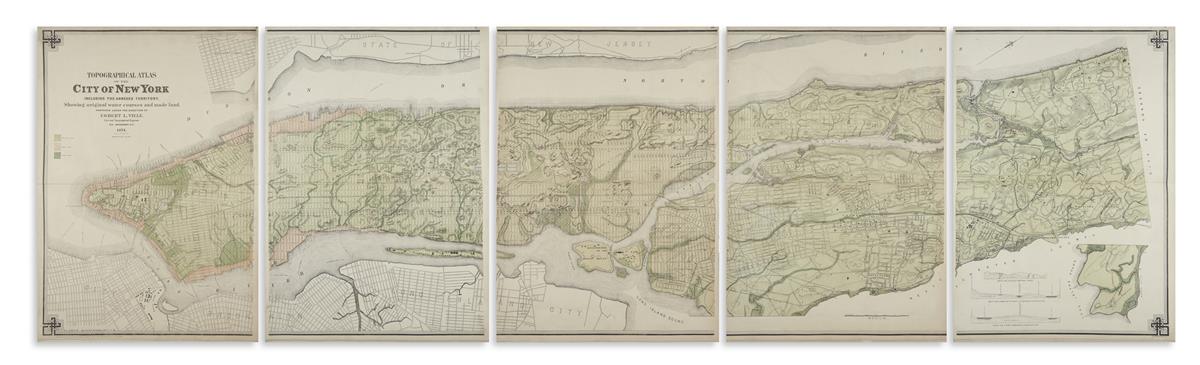
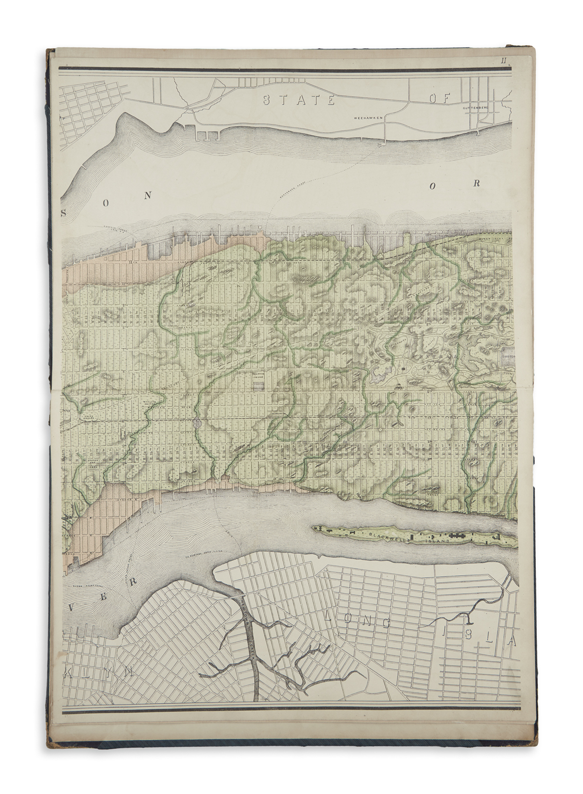
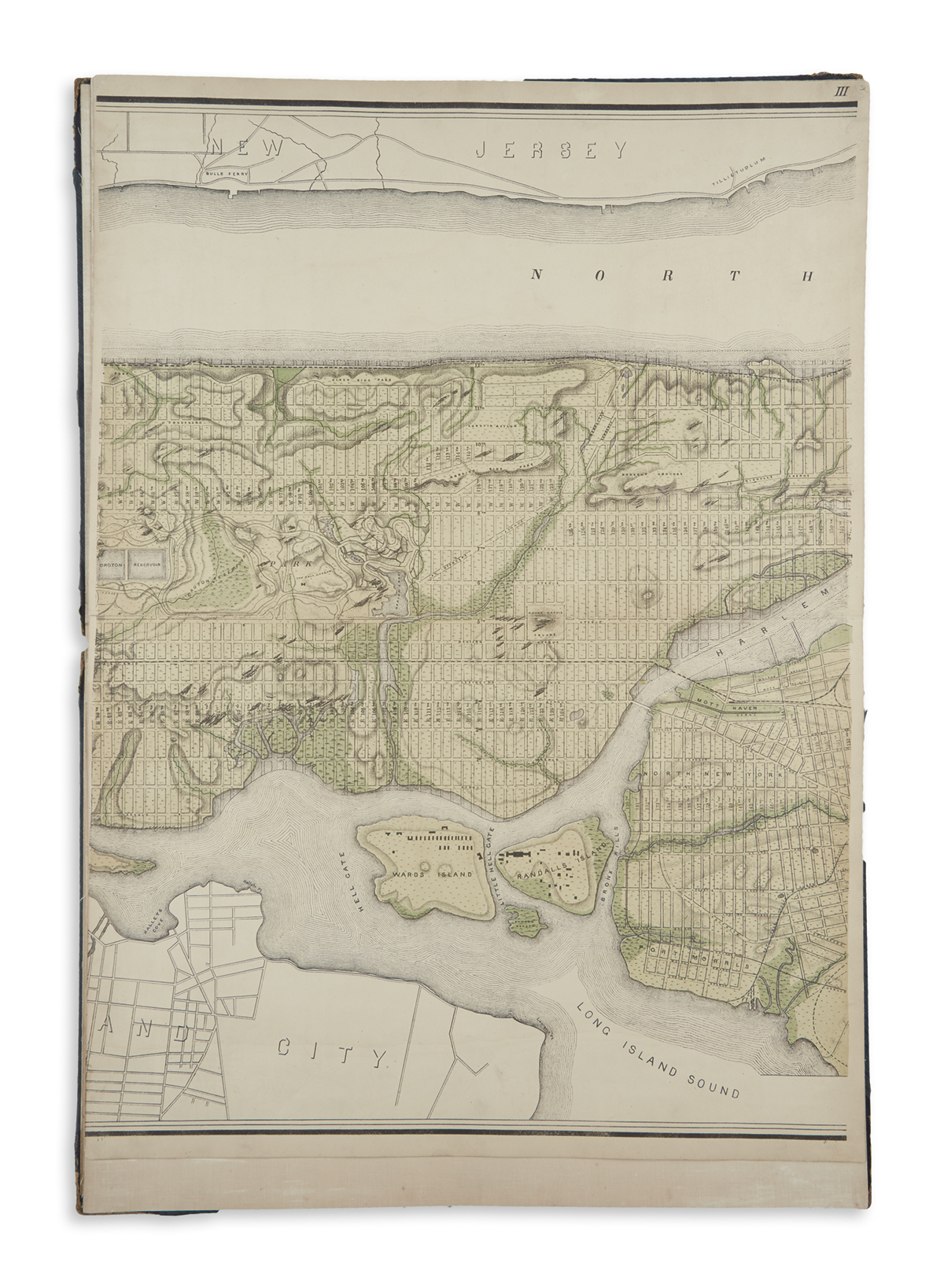
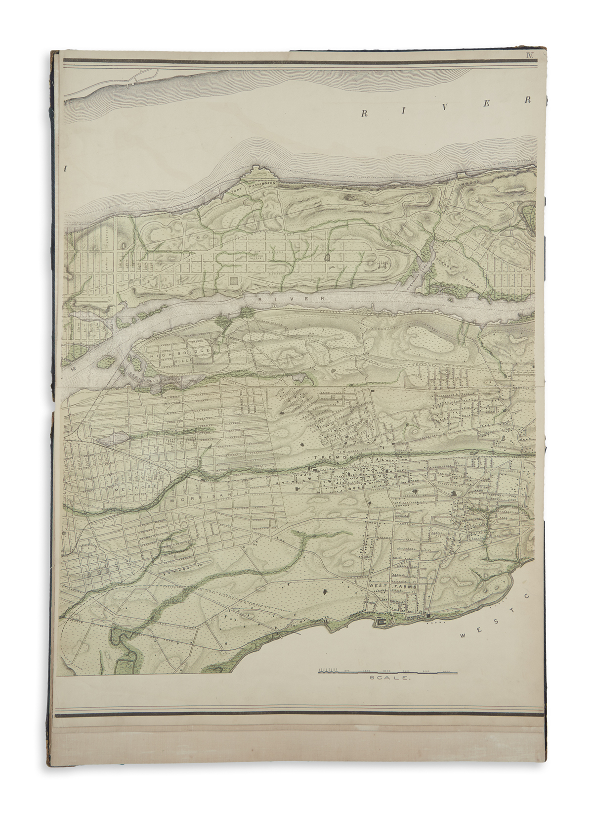
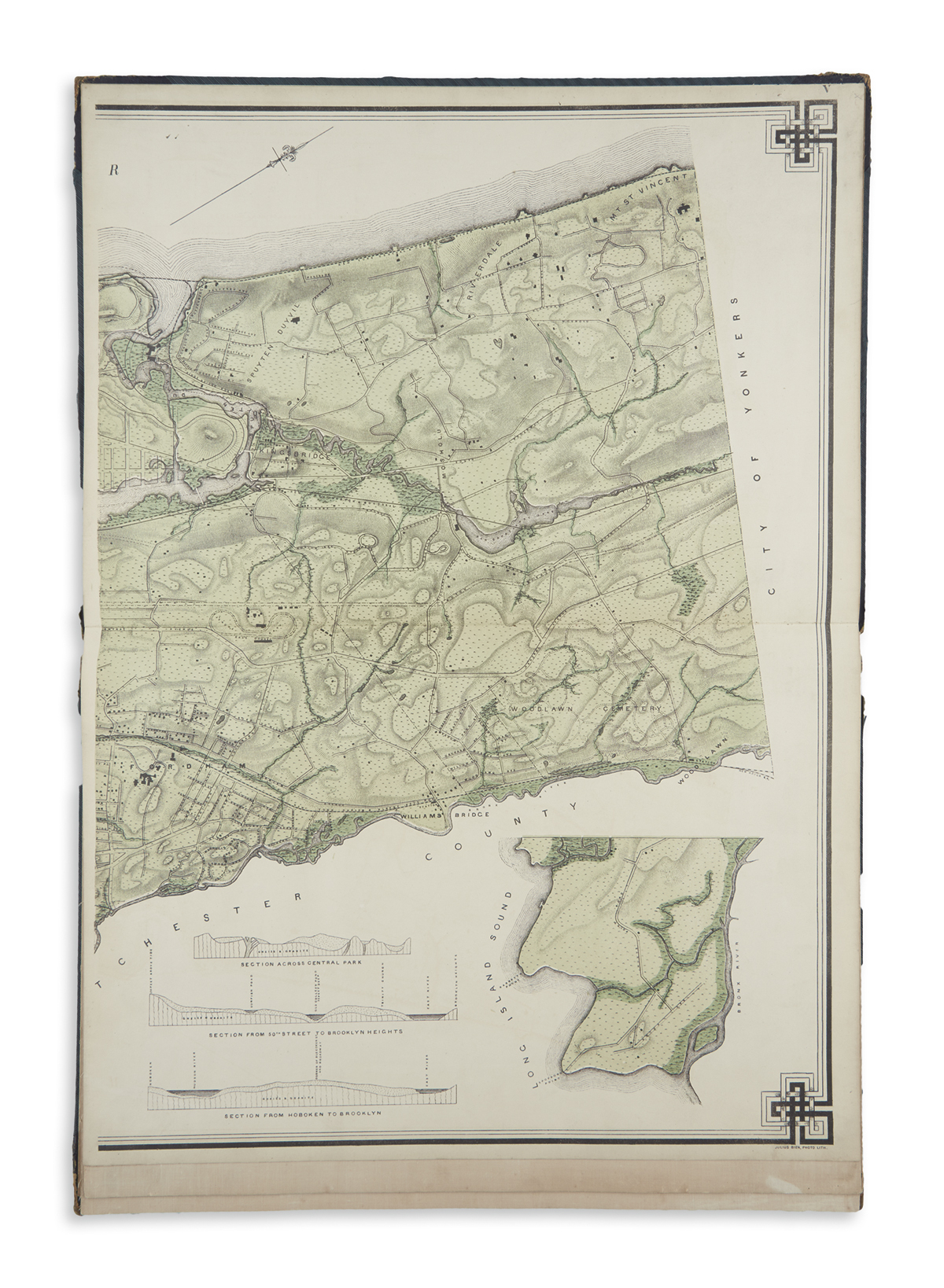
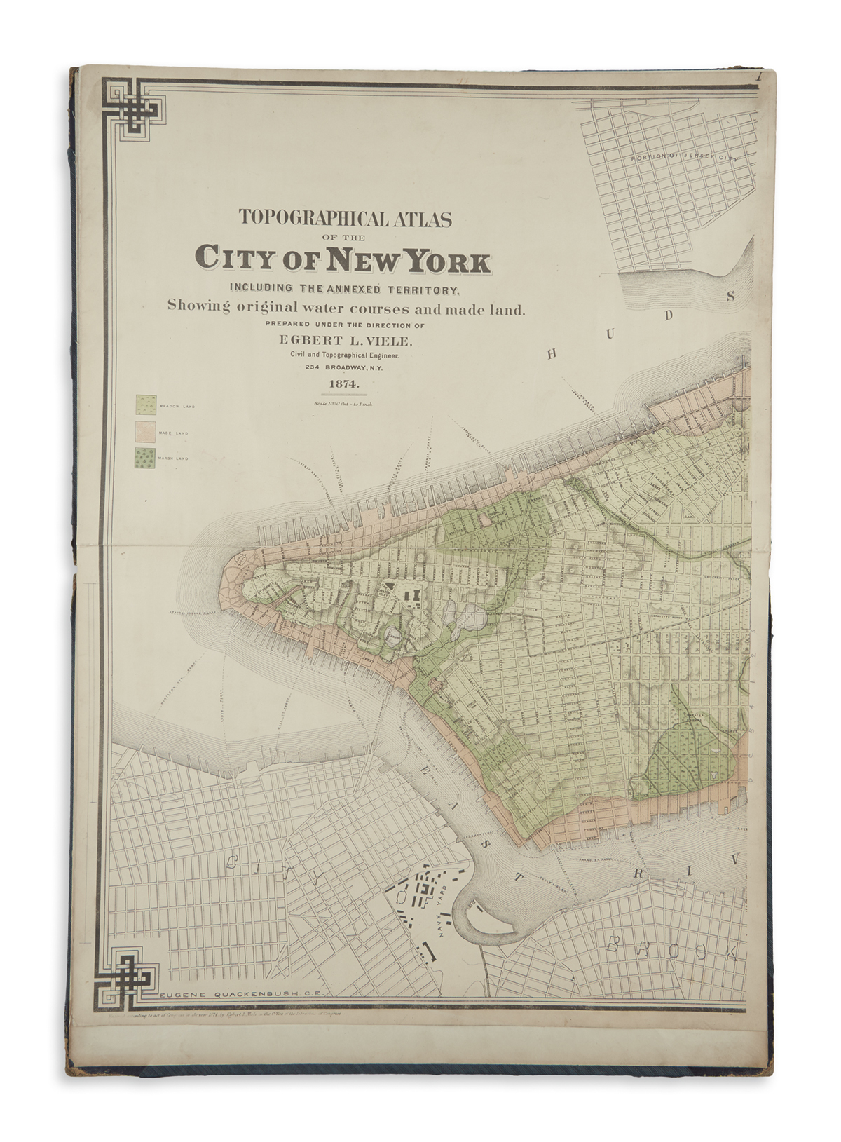
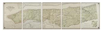
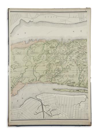
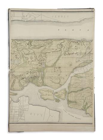
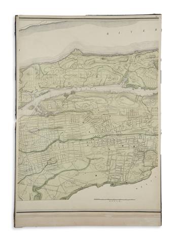
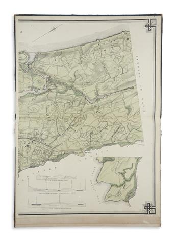
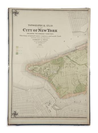
(NEW YORK CITY.) Viele, Egbert. Topographical Atlas of the City of New YorkIncluding the Annexed Territory, Showing Original Water Courses and Made Land. Large map of Manhattan and the Bronx on 5 linen backed double-page color-tinted lithographed sheets by Julius Bien. Folio, 20x14 inches, contemporary half calf, disbound; sheets clean with minor finger soiling at extremities. Ink inscription of New York law firm "Nehrbas & Pitshke, April 1877" on front pastedown. New York, 1874
Viele's 1865 "Water Map", revised and greatly enlarged to nearly twice the size by Civil Engineer Eugene Quackenbush. "Twenty years of surveying and studying went into perfecting this great map, and during those years Viele gained an intimate knowledge of New York's physical makeup." (Cohen and Augustyn, Manhattan in Maps, pages 136-139). A fine example of this scarce later, larger edition of the map.