Dec 10 at 12:00 PM - Sale 2689 -

Sale 2689 - Lot 150

Estimate: $ 700 - $ 1,000
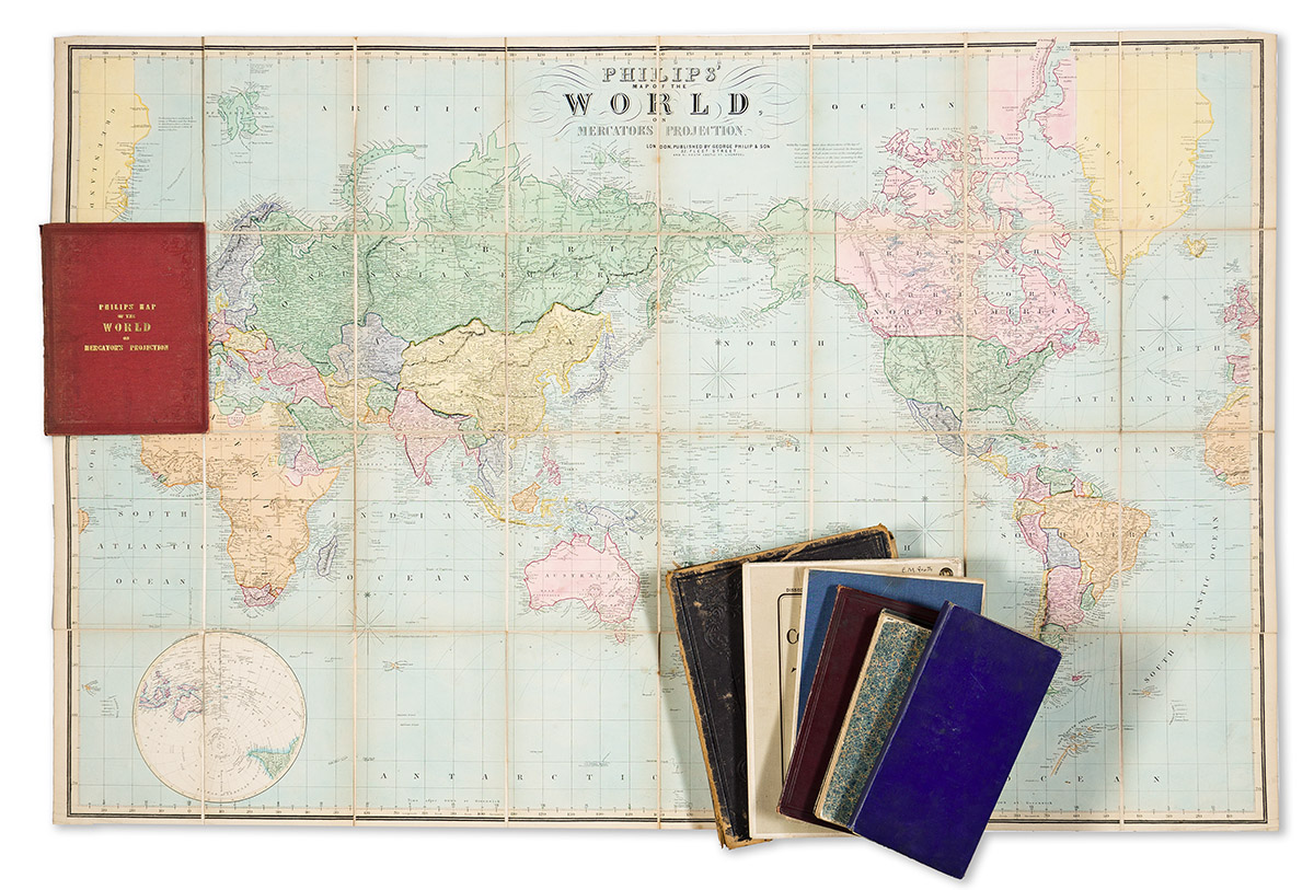
(WORLD.) Group of 7 large nineteenth-and-early-twentieth-century lithographed case maps. Individual photographs on request. Vp, vd

Additional Details

W. & A.K. Johnston. Johnston's Commercial Chart of the World on Mercator's Projection. Color-printed lithograph; 2 sections, 34x36 inches each, segmented, mounted on original linen backing and folding into publisher's 4to format gilt-blocked roan case; wear, soiling, maps separated from the covers. London, late 1850s.

John Bartholomew & Son. Bartholomew's Chart of the World on Mercator's Projection. Color-printed lithograph; 46x72 inches overall, segmented, mounted on original linen backing with brass hanging grommets, and folding into printed publisher's self-wrappers; minor signs of age. London, circa 1910.

W. & A.K. Johnston. The World Wide Series of Library and Office Maps. The World on Mercator's Projection. Lithograph with some color printing; 42x59 inches overall, segmented, mounted on original linen backing and folding into blue cloth self-wrappers; minor wear and pencil annotations. London, circa 1910.

G.W. Bacon & Co. Bacon's New Chart of the World on Mercator's Projection. Color-printed lithograph; 37½x47½ inches overall, segmented, mounted on original linen backing and folding into publisher's gilt-blocked cloth covers; minor wear, one short fold separation. London, circa 1910.

George Philip & Son. Philips' Map of the World on Mercator's Projection. Hand-colored lithograph; 34x52 inches overall, segmented, mounted on original linen backing and folding into publisher's gilt-blocked red cloth covers; minor edge wear and light tanning at folds. London, circa 1850s.

Grattan & Gilbert. Gilbert's Map of the World on Mercator's Projection. Hand-colored engraving; 34½x51½ inches overall, segmented, mounted on original linen backing and folding into marbled paper self-wrappers; minor wear and offset. London, 1842.

The Scarborough Company. Scarborough's Map of the World - North America and South America Shewing Countries and their Colonies Principal Transportation Lines, etc. / Scarborough's Map of the World - Europe, Asia, Africa and Australia Shewing Countries and their Colonies Principal Transportation Lines, etc. Double-sided chromolithograph; 39¾x37¾ inches overall, segmented, mounted on original linen backing and folding into publisher's blue cloth covers; varnished and slightly yellowed, some wear along fold lines. Indianapolis, 1907.