Jun 07, 2017 - Sale 2450

Sale 2450 - Lot 62

Price Realized: $ 7,500
?Final Price Realized includes Buyer’s Premium added to Hammer Price
Estimate: $ 2,500 - $ 3,500
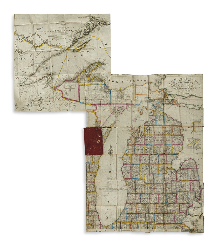
FARMER, JOHN. Map of the State of Michigan and the Surrounding Country. Large engraved folding map to which is attached: A Geological Map of the Mineral Region from the Official Plats of the United States Surveys and Chart of Lake Superior Reduced from the Survey and Chart of Lieut. Byfield of the R.N. by John Farmer. Primary map sheet 32x24 inches; secondary map sheet 19 1/2x19 3/4 inches; overall 44x38 3/4 inches; folding into publisher's 8vo format gilt lettered red roan case, a bit worn; original hand-color in outline by county; upper left corner of main map incised with secondary map overlayed and attached, repairable split along fold above cover, minor losses at a few fold intersections, early hand-drawn finger motif in red ink pointing to Detroit and Grand Haven with several towns along the Grand River highlighted. Detroit, 1846 and 1847

Additional Details

John Farmer was Michigan's most successful surveyor and map maker of the nineteenth century and his accurate and detailed maps were highly influential in the promotion of emigrants to the region during that time. In 1835 Farmer sold the publishing rights of his maps to the New York firm of J.H. Colton and in 1844 after a nearly 10 year pause in map production "brought out an entirely new map of the State of Michigan, which he engraved himself, and which represented a large amount of careful, conscientious work, and passed through many editions." The present map is the 1846 second edition of that debut and is not described in Karpinski. Further adding to the interest of this example is the nearly seamless attachment of Farmer's geological map of the Upper Peninsula to the northwest, in effect creating a much more "complete" map of the state. The geological map seen here is in keeping with the Library of Congress example noted in Karpinski, without borders and without the words "Engraved by J. Farmer." This map portion was separately entered in 1847 before the completion of the entire map. Karpinski 155H; and 164I.