HOMANN, JOHNN BAPTIST. Composite atlas. Two volumes. 200 hand-colored maps and city plans, of which 199 double-page and one folding. Double-page table. Two volumes. Folio, 21x13 inches, expertly bound to style in 1/4 18th century russia over period marbled paper-covered boards, spine with wide raised bands in six compartments, gilt double-fillets on either side of each band, lettered in gilt in the second and forth compartments. [Nuremberg: Homann Heirs, circa 1750]
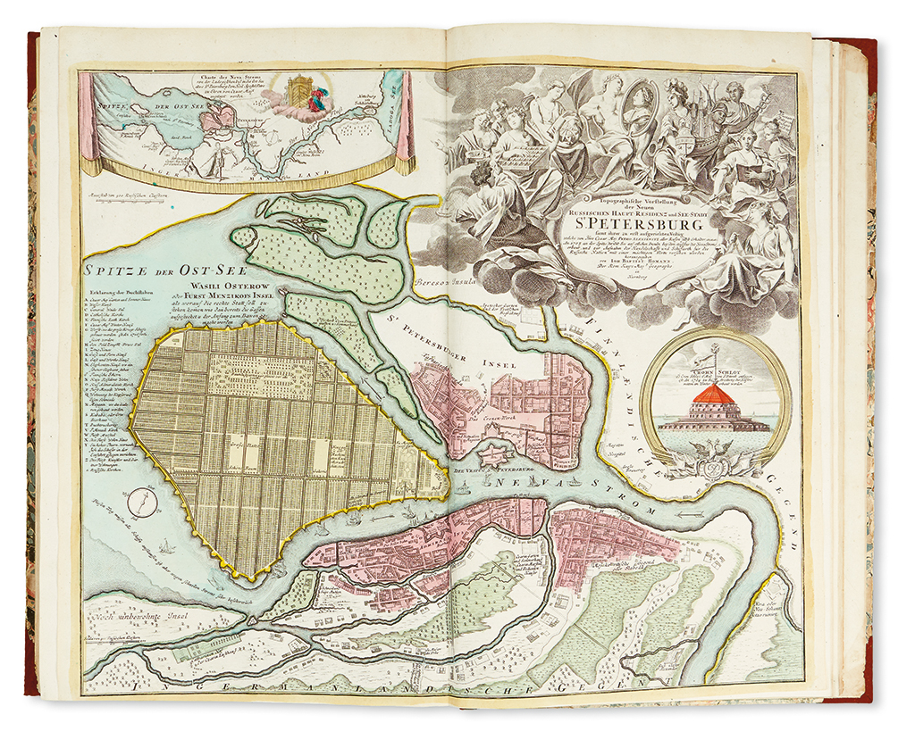
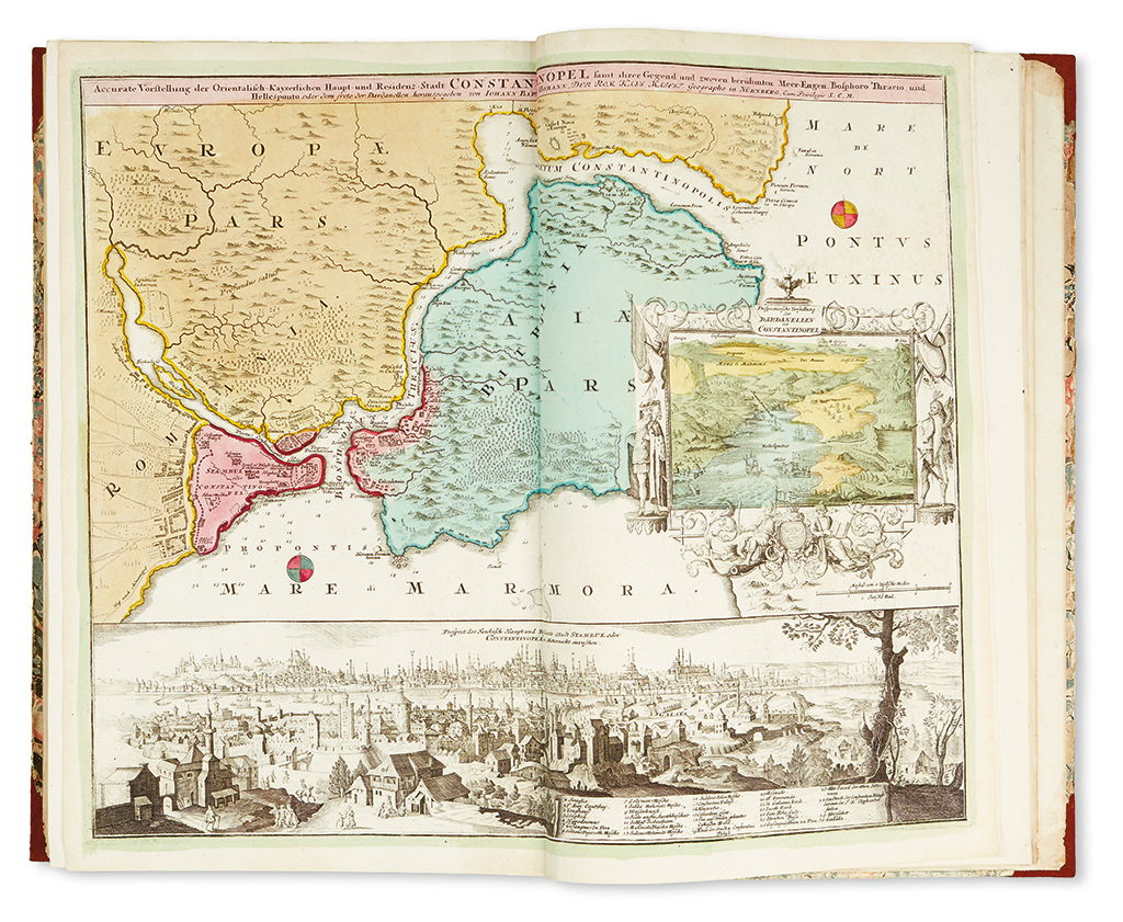
This composite atlas includes a double-hemispheric celestial map, continental maps of Europe, Africa and Asia, a map of the Holy Land, general and region specific maps of most European countries, as well as numerous city plans (including Paris, Madrid, Florence, Rome, Venice, Vienna, Berlin, Stockholm, Copenhagen, St. Petersburg and Constantinople, among others). Such composite atlases were assembled at the purchaser's request and vary greatly in terms of their content. It is unusual to find such atlases with full period hand-coloring throughout and with such a large number of city plans.
cf. Phillips 586; Shirley, Atlases, T.HOM-1a-11a; Heinz, M. 'A Programme for Map Publishing: The Homann Firm in the Eighteenth Century' in Imago Mundi Vol. 49, 1997, pages 104-115.