?Final Price Realized includes Buyer’s Premium added to Hammer Price
Estimate: $ 80,000 - $ 120,000
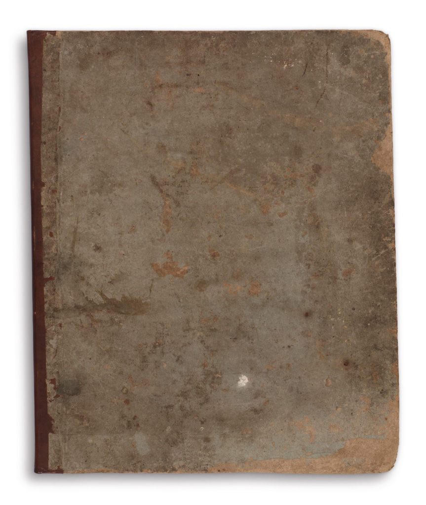
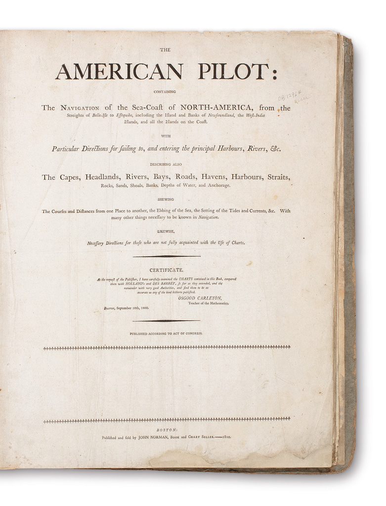
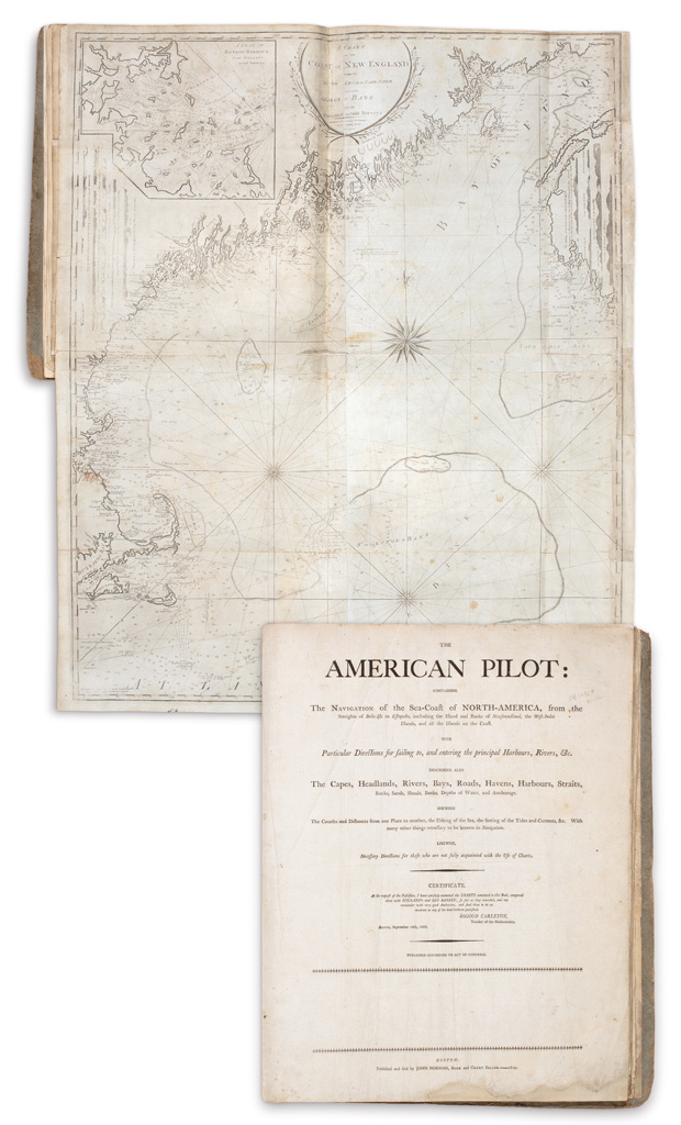
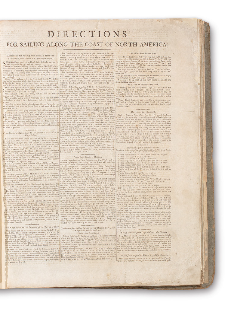
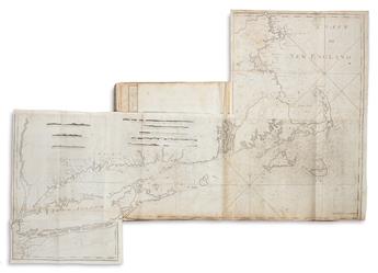
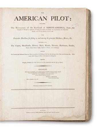
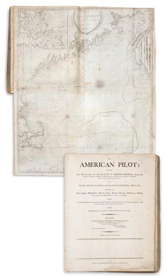
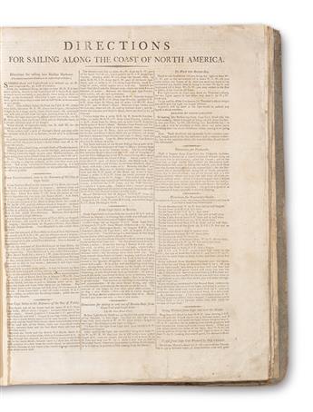
NORMAN, JOHN. The American Pilot: Containing the Navigation of the Sea-Coast of North-America. 11 double-page or folding engraved charts of the North American coast on heavy laid paper watermarked "AL Masso", letterpress title-page and 2 leaves of "Directions for Sailing Along the Coast of North America" on wove paper. Folio, 21x17 inches, contemporary drab boards gently worn and rebacked in a simple calf spine; preliminaries with marginal repairs, verso of title lined with thin tissue, charts on later guards with minimal soiling and edge wear, two charts with small separations at fold intersections, chart of the Coast of New England with repairs to right edge including small portions of the degree border reinstated in sympathetic facsimile. Boston: John Norman, 1810
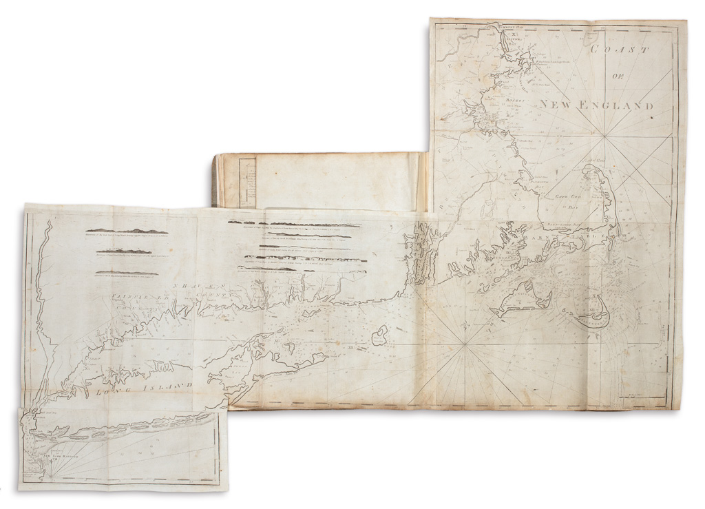
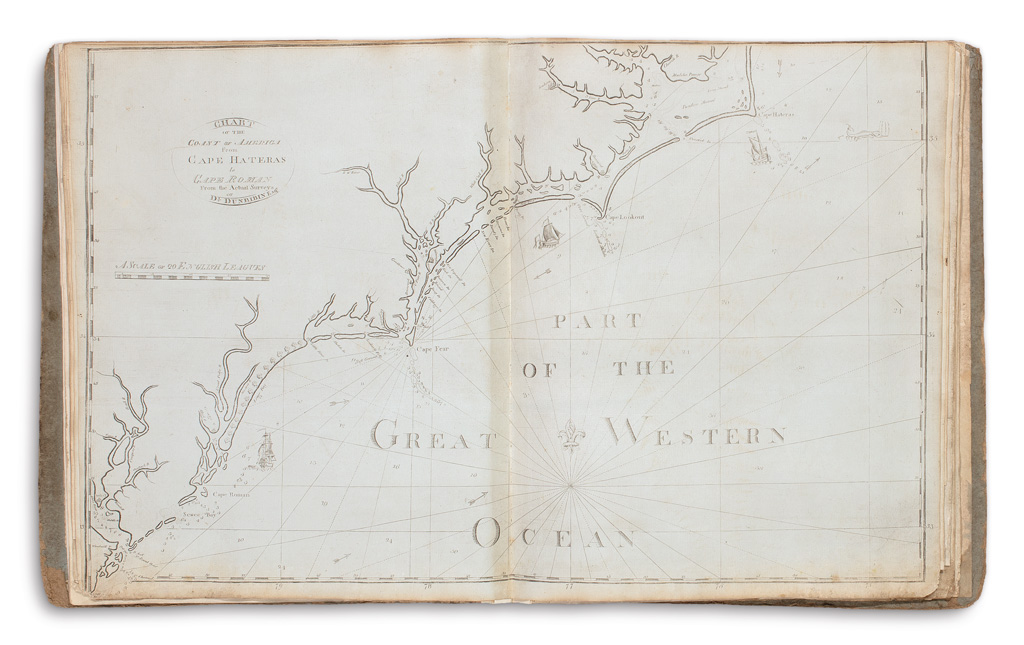
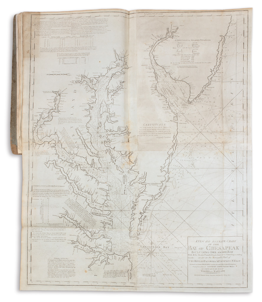
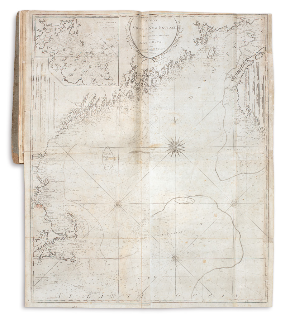
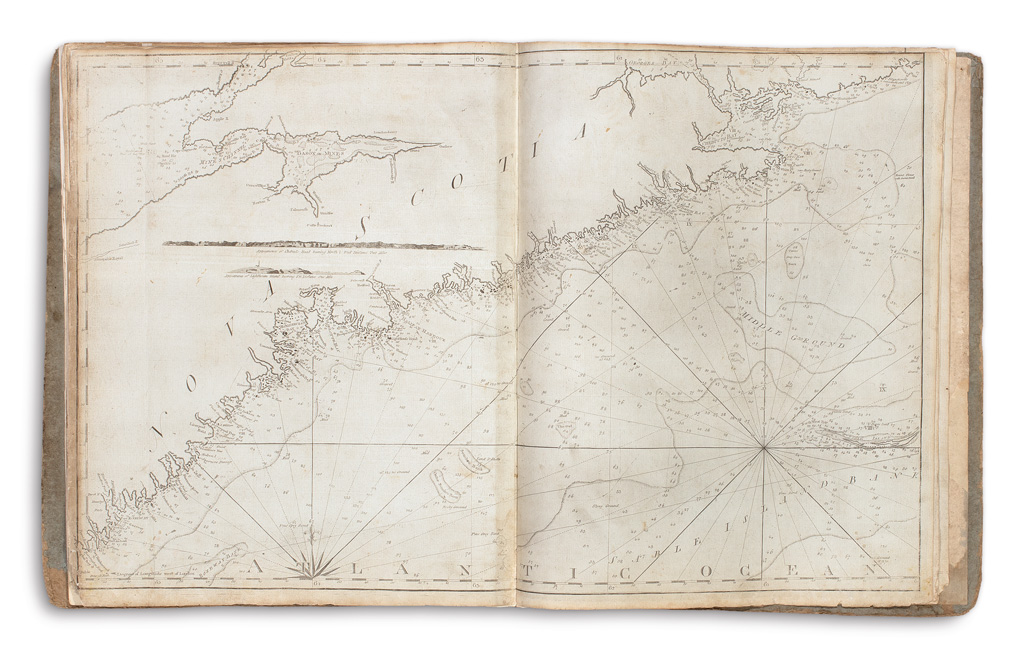
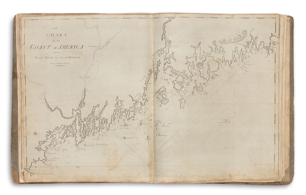
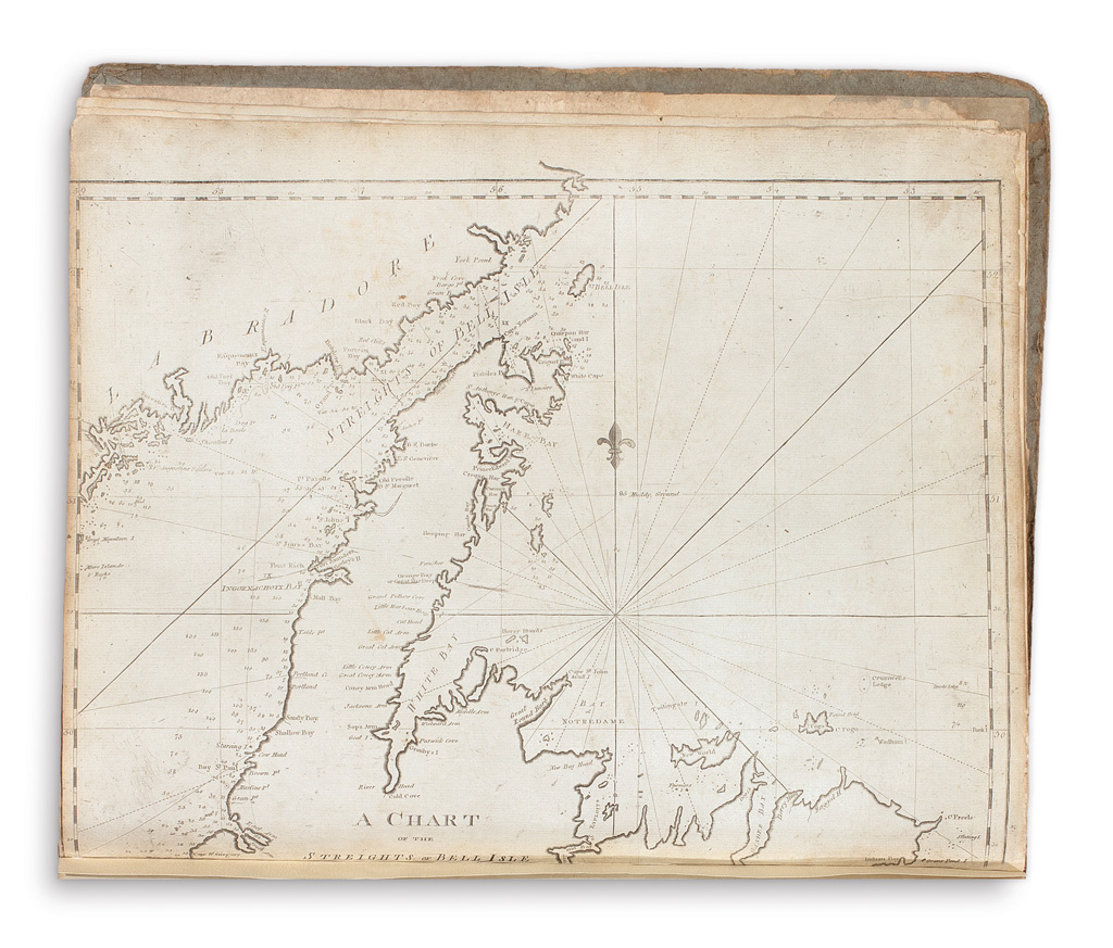
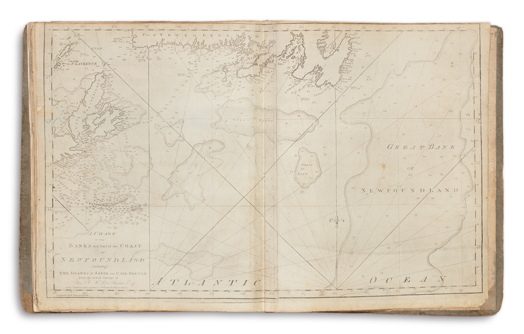
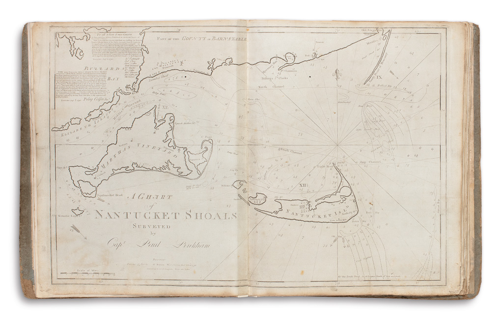
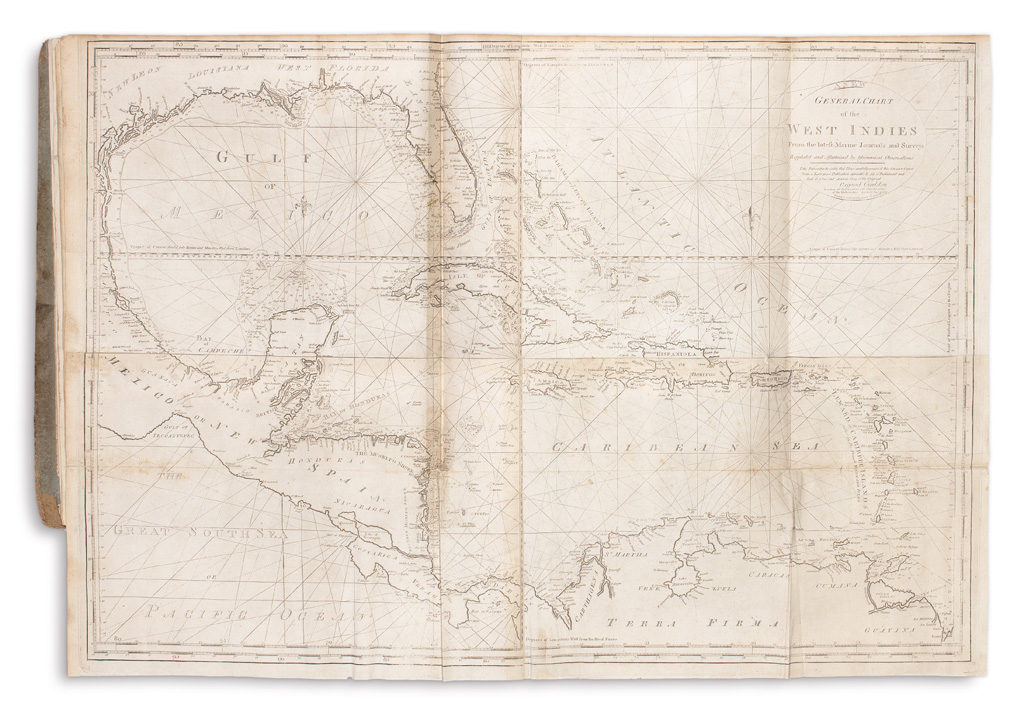
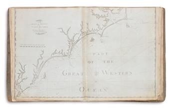
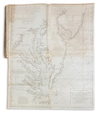
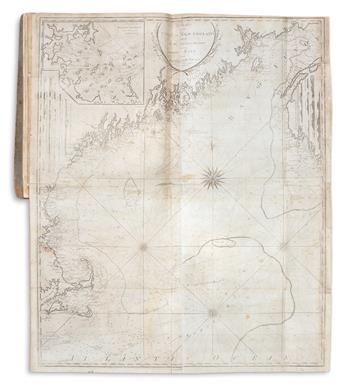
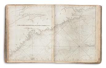
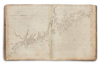
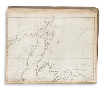
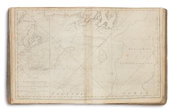
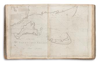
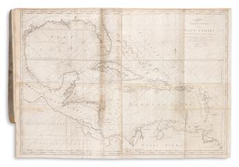
1.) A Chart of Nantucket Shoals Surveyed by Capt. Paul Pinkham. 2 sheets joined, 21x32 3/4 inches. Wheat & Brun 221, state 3. 2.) A New General Chart of the West Indies from the Latest Marine Journals and Surveys. 4 sheets joined, 28x40 1/2 inches. Wheat & Brun 683. 3.) A Chart of South Carolina and Georgia. Single sheet, 20 3/4x16 1/2 inches. Wheat & Brun 607, state 3. 4.) Chart of the Coast of America from Cape Hateras to Cape Roman from the Actual Surveys of Dl. Dunbibin Esqr. 2 sheets joined, 20 3/4x32 1/2 inches. Wheat & Brun 589, state 5. 5.) A New and Accurate Chart of the Bay of Chesapeak Including Delaware Bay. 4 sheets joined, 42x34 1/2 inches. Wheat & Brun 310, state 2. 6.) [Chart from New York to Timber Island Including Nantucket Shoals from the Latest Surveys.] 5 sheets joined, 54 1/2x39 1/2 inches overall. Wheat & Brun 157, state 3 (without title). 7.) A Chart of the Coast of New England from the South Shoal to Cape Sable Including George's Bank from Holland's Actual Surveys. 4 sheets joined, 35x41 1/2 inches. Wheat & Brun 159, state 2. 8.) A Chart of the Coast of America from Wood's Island to Good Harbor. 2 sheets joined, 21x32 1/2 inches. Wheat & Brun 166, state 2. 9.) [Chart of the Coast of Nova Scotia from Cape Sable to Forked Harbor.] 2 sheets joined, 21x33 1/4 inches. 10.) A Chart of the Streights of Bell Isle. Single sheet, 16 1/2x21 inches. Wheat & Brun 107, state 2. 11.) A Chart of the Banks of and Part of the Coast of Newfoundland Including the Islands of Sable and Cape Breton from the Actual Surveys of Jos. F.W. Des Barres Esqr. 2 sheets joined, 21x33 inches.
John Norman's American Pilot is the second atlas of nautical charts to be published in America. First issued in 1791, it was preceded only by Matthew Clark's Complete Set of Charts of the Coast of America in 1790. Following the success of Clark's work, to which Norman contributed several engravings, Norman realized the strong call for detailed maps of American waters and began assembling and promoting his own marine atlas. These charts of the coastline from Maine to Georgia were genuinely significant, offering accurate sailing directions to the growing fleets of commercial pilots in the post-Revolutionary War period. With the loss of the war, Britain also lost much of its long-held authority of mapping in America. This left an American printer such as Norman the opportunity to succeed at a new enterprise, meeting the demands of the day with charts produced from the newest and most accurate surveys. Norman's charts appeared in several subsequent editions and those dating from 1794-1803 bear the publication imprint of William Norman, generally thought to be the son, with John's name re-appearing in 1810, as here, and Andrew Allen in the final edition of 1816.
Considering the fact that these charts were designed, created and sold for use aboard turn of the 19th century sailing vessels, the survival rate is quite small. Separate charts from any edition scarcely appear on the market; a complete Pilot in good condition, as presently offered, is particularly rare. Phillips Atlases 4477 (1803 edition, collating the same as the present); Robert Ericson, A Bibliography of The American Pilot.