Dec 08, 2005 - Sale 2060

Sale 2060 - Lot 100

Price Realized: $ 1,955
?Final Price Realized includes Buyer’s Premium added to Hammer Price
Estimate: $ 500 - $ 750
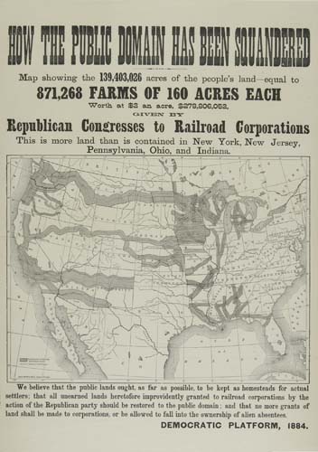
RAND, McNALLY & Co. Map showing the 139,403,026 acres of the people's land - equal to 871,268 Farms of 160 acres each . . . Given by Republican Congresses to Railroad Corporations. Lithographed map on a political broadside, 590x420 mm sheet size, with map filling about half of the sheet. Chicago, 1884

Additional Details


Highly unusual map showing the Congressional land grants to Railroad Companies given in exchange for construction of westward leading rail lines. The map was produced by Rand, McNally & Co. on order of the Democratic Party during the acrimonious 1884 U. S. Presidential election period. A western and political classic in an amazing state of preservation. Ristow, page 477.