Dec 08, 2005 - Sale 2060

Sale 2060 - Lot 101

Price Realized: $ 3,450
?Final Price Realized includes Buyer’s Premium added to Hammer Price
Estimate: $ 4,000 - $ 6,000
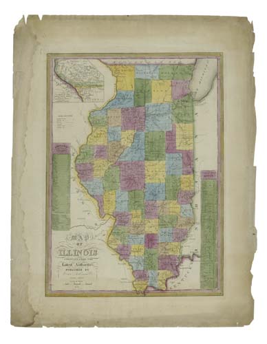
ROBINSON, LEWIS. Map of Illinois compiled from the Latest Authorities. Engraved map, 570x415 mm, wide margins; hand-colored; somewhat toned overall, darker in the margins; dampstaining in the left margin but well away from the map, some soiling. Akron, OH, 1838

Additional Details


Extremely rare map with only the British Library copy recorded. Robinson started his mapmaking activities in 1828 and prospered in the town of South Reading in Vermont. Most of his scarce maps, including the 4-sheet map of the United States were published in Vermont. However, as noted by Dalphin & McCorison, "In 1836, with two of his brothers-in-law, [Levi and Samuel Manning] Robinson established a large map publishing business in Akron, Ohio, and his maps were sold throughout the western states. Maps of Indiana, 1836, Ohio, 1837, Connecticut Reserve, 1837, Illinois, 1838, and Akron, c. 1836, were issued from this branch office." Robinson's map of Vermont, map of New Hampshire and combined map of Vermont & New Hampshire enjoyed some popularity, with Robinson selling respectively, 772, 1993 and 1609 copies of each in the time period between 1840 and 1855. Unfortunately, that was not the case with his map of Illinois. Robinson's business records show that he sold only 8 copies of the map in 1840, 10 copies in 1841 and 1 copy in 1845, for a total of 19 maps during the 16-year time period 1840-1855. Ristow, pages 271-273.